At present, large displacement horizontal well technology is applied domestic and abroad,
thin layer mining puts forward high requirements for drilling quality. 3D geological
guidance system can bring intuitive and clear understanding of geological structure to field
engineers, so that they can guide drilling production more accurately. The three-dimensional
geological guidance system for horizontal wells is being developed, using seismic
interpretation results, structural contours, temporary well data to form three-dimensional
structural geological bodies, establishing geological guidance model, carrying out wellbore
trajectory tracking and oil and gas display analysis near the drilling bit, adjusting the
guiding model in real time according to the field operation, guiding the horizontal well
drilling construction and prediction analysis in real time, and improving the reservoir
drilling rate.


 二维/三维建模。

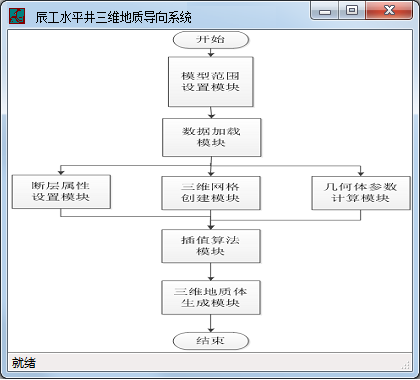 图1
工作流程
图1
工作流程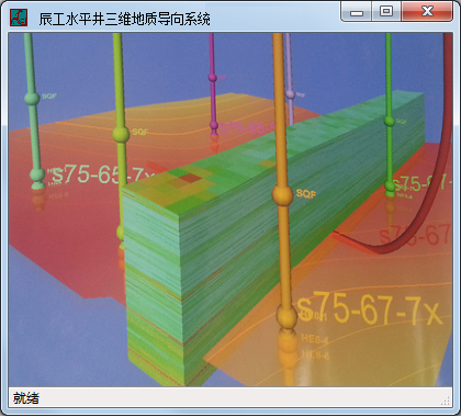 图2
三维地质导向示意
图2
三维地质导向示意 
